Goose Green

Wednesday, August 06, 2008

Chapter 3 - Fringing or shore-reefs
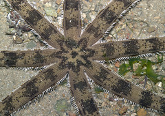
Eight-armed sea star (Luidia sp.) at Pulau SekuduImage by wildsingapore via Flickr


CHAPTER III.--FRINGING OR SHORE-REEFS.

Reefs of Mauritius.--Shallow channel within the reef.--Its slow filling
up.--Currents of water formed within it.--Upraised reefs.--Narrow
fringing-reefs in deep seas.--Reefs on the coast of East Africa and of
Brazil.--Fringing-reefs in very shallow seas, round banks of sediment and
on worn-down islands.--Fringing-reefs affected by currents of the sea.--
Coral coating the bottom of the sea, but not forming reefs.

Fringing-reefs, or, as they have been called by some voyagers, shore-reefs,
whether skirting an island or part of a continent, might at first be
thought to differ little, except in generally being of less breadth, from
barrier-reefs. As far as the superficies of the actual reef is concerned
this is the case; but the absence of an interior deep-water channel, and
the close relation in their horizontal extension with the probable slope
beneath the sea of the adjoining land, present essential points of
difference.

The reefs which fringe the island of Mauritius offer a good example of this
class. They extend round its whole circumference, with the exception of
two or three parts (This fact is stated on the authority of the Officier du
Roi, in his extremely interesting "Voyage a l'Isle de France," undertaken
in 1768. According to Captain Carmichael (Hooker's "Bot. Misc." volume
ii., page 316) on one part of the coast there is a space for sixteen miles
without a reef.), where the coast is almost precipitous, and where, if as
is probable the bottom of the sea has a similar inclination, the coral
would have no foundation on which to become attached. A similar fact may
sometimes be observed even in reefs of the barrier class, which follow much
less closely the outline of the adjoining land; as, for instance, on the
south-east and precipitous side of Tahiti, where the encircling reef is
interrupted. On the western side of the Mauritius, which was the only part
I visited, the reef generally lies at the distance of about half a mile
from the shore; but in some parts it is distant from one to two, and even
three miles. But even in this last case, as the coast-land is gently
inclined from the foot of the mountains to the sea-beach, and as the
soundings outside the reef indicate an equally gentle slope beneath the
water, there is no reason for supposing that the basis of the reef, formed
by the prolongation of the strata of the island, lies at a greater depth
than that at which the polypifers could begin constructing the reef. Some
allowance, however, must be made for the outward extension of the corals on
a foundation of sand and detritus, formed from their own wear, which would
give to the reef a somewhat greater vertical thickness, than would
otherwise be possible.

The outer edge of the reef on the western or leeward side of the island is
tolerably well defined, and is a little higher than any other part. It
chiefly consists of large strongly branched corals, of the genus Madrepora,
which also form a sloping bed some way out to sea: the kinds of coral
growing in this part will be described in the ensuing chapter. Between the
outer margin and the beach, there is a flat space with a sandy bottom and a
few tufts of living coral; in some parts it is so shallow, that people, by
avoiding the deeper holes and gullies, can wade across it at low water; in
other parts it is deeper, seldom however exceeding ten or twelve feet, so
that it offers a safe coasting channel for boats. On the eastern and
windward side of the island, which is exposed to a heavy surf, the reef was
described to me as having a hard smooth surface, very slightly inclined
inwards, just covered at low-water, and traversed by gullies; it appears to
be quite similar in structure to the reefs of the barrier and atoll
classes.

The reef of Mauritius, in front of every river and streamlet, is breached
by a straight passage: at Grand Port, however, there is a channel like
that within a barrier-reef; it extends parallel to the shore for four
miles, and has an average depth of ten or twelve fathoms; its presence may
probably be accounted for by two rivers which enter at each end of the
channel, and bend towards each other. The fact of reefs of the fringing
class being always breached in front of streams, even of those which are
dry during the greater part of the year, will be explained, when the
conditions unfavourable to the growth of coral are considered. Low
coral-islets, like those on barrier-reefs and atolls, are seldom formed on
reefs of this class, owing apparently in some cases to their narrowness, and
in others to the gentle slope of the reef outside not yielding many fragments
to the breakers. On the windward side, however, of the Mauritius, two or
three small islets have been formed.

It appears, as will be shown in the ensuing chapter, that the action of the
surf is favourable to the vigorous growth of the stronger corals, and that
sand or sediment, if agitated by the waves, is injurious to them. Hence it
is probable that a reef on a shelving shore, like that of Mauritius, would
at first grow up, not attached to the actual beach, but at some little
distance from it; and the corals on the outer margin would be the most
vigorous. A shallow channel would thus be formed within the reef, and as
the breakers are prevented acting on the shores of the island, and as they
do not ordinarily tear up many fragments from the outside, and as every
streamlet has its bed prolonged in a straight line through the reef, this
channel could be filled up only very slowly with sediment. But a beach of
sand and of fragments of the smaller kinds of coral seems, in the case of
Mauritius, to be slowly encroaching on the shallow channel. On many
shelving and sandy coasts, the breakers tend to form a bar of sand a little
way from the beach, with a slight increase of depth within it; for
instance, Captain Grey (Captain Grey's "Journal of Two Expeditions," volume
i. page 369.) states that the west coast of Australia, in latitude 24 deg.,
is fronted by a sand bar about two hundred yards in width, on which there
is only two feet of water; but within it the depth increases to two
fathoms. Similar bars, more or less perfect, occur on other coasts. In
these cases I suspect that the shallow channel (which no doubt during
storms is occasionally obliterated) is scooped out by the flowing away of
the water thrown beyond the line, on which the waves break with the
greatest force. At Pernambuco a bar of hard sandstone (I have described
this singular structure in the "London and Edinburgh Phil. Mag." October
1841.), which has the same external form and height as a coral-reef,
extends nearly parallel to the coast; within this bar currents, apparently
caused by the water thrown over it during the greater part of each tide,
run strongly, and are wearing away its inner wall. From these facts it can
hardly be doubted, that within most fringing-reefs, especially within those
lying some distance from the land, a return stream must carry away the
water thrown over the outer edge; and the current thus produced, would tend
to prevent the channel being filled up with sediment, and might even deepen
it under certain circumstances. To this latter belief I am led, by finding
that channels are almost universally present within the fringing-reefs of
those islands which have undergone recent elevatory movements; and this
could hardly have been the case, if the conversion of the very shallow
channel into land had not been counteracted to a certain extent.

A fringing-reef, if elevated in a perfect condition above the level of the
sea, ought to present the singular appearance of a broad dry moat within a
low mound. The author ("Voyage a l'Isle de France, par un Officier du
Roi," part i., pages 192, 200.) of an interesting pedestrian tour round the
Mauritius, seems to have met with a structure of this kind: he says
"J'observai que la, ou la mer etale, independamment des rescifs du large,
il y a terre UNE ESPECE D'EFFONCEMENT ou chemin couvert naturel. On y
pourrait mettre du canon," etc. In another place he adds, "Avant de passer
le Cap, on remarque un gros banc de corail eleve de plus de quinze pieds:
c'est une espece de rescif, que la mer abandonne, il regne au pied une
longue flaque d'eau, dont on pourrait faire un bassin pour de petits
vaisseaux." But the margin of the reef, although the highest and most
perfect part, from being most exposed to the surf, would generally during a
slow rise of the land be either partially or entirely worn down to that
level, at which corals could renew their growth on its upper edge. On some
parts of the coast-land of Mauritius there are little hillocks of coral-rock,
which are either the last remnants of a continuous reef, or of low
islets formed on it. I observed that two such hillocks between Tamarin Bay
and the Great Black River; they were nearly twenty feet high, about two
hundred yards from the present beach, and about thirty feet above its
level. They rose abruptly from a smooth surface, strewed with worn
fragments of coral. They consisted in their lower part of hard calcareous
sandstone, and in their upper of great blocks of several species of Astraea
and Madrepora, loosely aggregated; they were divided into irregular beds,
dipping seaward, in one hillock at an angle of 8 deg., and in the other at
18 deg. I suspect that the superficial parts of the reefs, which have been
upraised together with the islands they fringe, have generally been much
more modified by the wearing action of the sea, than those of Mauritius.

Many islands are fringed by reefs quite similar to those of Mauritius (I
may give Cuba, as another instance; Mr. Taylor ("Loudon's Mag. of Nat.
Hist." volume ix., page 449) has described a reef several miles in length
between Gibara and Vjaro, which extends parallel to the shore at the
distance of between half and the third part of a mile, and encloses a space
of shallow water, with a sandy bottom and tufts of coral. Outside the edge
of the reef, which is formed of great branching corals, the depth is six
and seven fathoms. This coast has been upheaved at no very distant
geological period."); but on coasts where the sea deepens very suddenly the
reefs are much narrower, and their limited extension seems evidently to
depend on the high inclination of the submarine slope; a relation, which,
as we have seen, does not exist in reefs of the barrier class. The
fringing-reefs on steep coasts are frequently not more than from fifty to
one hundred yards in width; they have a nearly smooth, hard surface,
scarcely uncovered at low water, and without any interior shoal channel,
like that within those fringing-reefs, which lie at a greater distance from
the land. The fragments torn up during gales from the outer margin are
thrown over the reef on the shores of the island. I may give as instances,
Wateeo, where the reef is described by Cook as being a hundred yards wide;
and Mauti and Elizabeth Islands (Mauti is described by Lord Byron in the
voyage of H.M.S. "Blonde", and Elizabeth Island by Captain Beechey.), where
it is only fifty yards in width: the sea round these islands is very deep.

Fringing-reefs, like barrier-reefs, both surround islands, and front the
shores of continents. In the charts of the eastern coast of Africa, by
Captain Owen, many extensive fringing-reefs are laid down; thus, for a
space of nearly forty miles, from latitude 1 deg 15' to 1 deg 45' S., a
reef fringes the shore at an average distance of rather more than one mile,
and therefore at a greater distance than is usual in reefs of this class;
but as the coast-land is not lofty, and as the bottom shoals very gradually
(the depth being only from eight to fourteen fathoms at a mile and a half
outside the reef), its extension thus far from the land offers no
difficulty. The external margin of this reef is described, as formed of
projecting points, within which there is a space, from six to twelve feet
deep, with patches of living coral on it. At Mukdeesha (latitude 2 deg 1'
N.) "the port is formed," it is said (Owen's "Africa," volume i., page 357,
from which work the foregoing facts are likewise taken.) "by a long reef
extending eastward, four or five miles, within which there is a narrow
channel, with ten to twelve feet of water at low spring-tides;" it lies at
the distance of a quarter of a mile from the shore. Again, in the plan of
Mombas (latitude 4 deg S.), a reef extends for thirty-six miles, at the
distance of from half a mile to one mile and a quarter from the shore;
within it, there is a channel navigable "for canoes and small craft,"
between six and fifteen feet deep: outside the reef the depth is about
thirty fathoms at the distance of nearly half a mile. Part of this reef is
very symmetrical, and has a uniform breadth of two hundred yards.

The coast of Brazil is in many parts fringed by reefs. Of these, some are
not of coral formation; for instance, those near Bahia and in front of
Pernambuco; but a few miles south of this latter city, the reef follows
(See Baron Roussin's "Pilote du Bresil," and accompanying hydrographical
memoir.) so closely every turn of the shore, that I can hardly doubt it is
of coral; it runs at the distance of three-quarters of a mile from the
land, and within it the depth is from ten to fifteen feet. I was assured
by an intelligent pilot that at Ports Frances and Maceio, the outer part of
the reef consists of living coral, and the inner of a white stone, full of
large irregular cavities, communicating with the sea. The bottom of the
sea off the coast of Brazil shoals gradually to between thirty and forty
fathoms, at the distance of between nine and ten leagues from the land.

From the description now given, we must conclude that the dimensions and
structure of fringing-reefs depend entirely on the greater or less
inclination of the submarine slope, conjoined with the fact that
reef-building polypifers can exist only at limited depths. It follows from
this, that where the sea is very shallow, as in the Persian Gulf and in
parts of the East Indian Archipelago, the reefs lose their fringing
character, and appear as separate and irregularly scattered patches, often
of considerable area. From the more vigorous growth of the coral on the
outside, and from the conditions being less favourable in several respects
within, such reefs are generally higher and more perfect in their marginal
than in their central parts; hence these reefs sometimes assume (and this
circumstance ought not to be overlooked) the appearance of atolls; but they
differ from atolls in their central expanse being much less deep, in their
form being less defined, and in being based on a shallow foundation. But
when in a deep sea reefs fringe banks of sediment, which have accumulated
beneath the surface, round either islands or submerged rocks, they are
distinguished with difficulty on the one hand from encircling barrier-reefs,
and on the other from atolls. In the West Indies there are reefs,
which I should probably have arranged under both these classes, had not the
existence of large and level banks, lying a little beneath the surface,
ready to serve as the basis for the attachment of coral, been occasionally
brought into view by the entire or partial absence of reefs on them, and
had not the formation of such banks, through the accumulation of sediment
now in progress, been sufficiently evident. Fringing-reefs sometimes coat,
and thus protect the foundations of islands, which have been worn down by
the surf to the level of the sea. According to Ehrenberg, this has been
extensively the case with the islands in the Red Sea, which formerly ranged
parallel to the shores of the mainland, with deep water within them: hence
the reefs now coating their bases are situated relatively to the land like
barrier-reefs, although not belonging to that class; but there are, as I
believe, in the Red Sea some true barrier-reefs. The reefs of this sea and
of the West Indies will be described in the Appendix. In some cases,
fringing-reefs appear to be considerably modified in outline by the course
of the prevailing currents. Dr. J. Allan informs me that on the east coast
of Madagascar almost every headland and low point of sand has a coral-reef
extending from it in a S.W. and N.E. line, parallel to the currents on that
shore. I should think the influence of the currents chiefly consisted in
causing an extension, in a certain direction, of a proper foundation for
the attachment of the coral. Round many intertropical islands, for
instance the Abrolhos on the coast of Brazil surveyed by Captain Fitzroy,
and, as I am informed by Mr. Cuming, round the Philippines, the bottom of
the sea is entirely coated by irregular masses of coral, which although
often of large size, do not reach the surface and form proper reefs. This
must be owing, either to insufficient growth, or to the absence of those
kinds of corals which can withstand the breaking of the waves.

The three classes, atoll-formed, barrier, and fringing-reefs, together with
the modifications just described of the latter, include all the most
remarkable coral formations anywhere existing. At the commencement of the
last chapter in the volume, where I detail the principles on which the map
(Plate III.) is coloured, the exceptional cases will be enumerated.


Zemanta Pixie

Labels: , , , , , , ,

Chapter 2 - Barrier Reefs

Butterflyfish and coralImage by richard ling via Flickr

CHAPTER II.--BARRIER REEFS.


Closely resemble in general form and structure atoll-reefs.--Width and
depth of the lagoon-channels.--Breaches through the reef in front of
valleys, and generally on the leeward side.--Checks to the filling up of
the lagoon-channels.--Size and constitution of the encircled islands.--
Number of islands within the same reef.--Barrier-reefs of New Caledonia and
Australia.--Position of the reef relative to the slope of the adjoining
land.--Probable great thickness of barrier-reefs.

The term "barrier" has been generally applied to that vast reef which
fronts the N.E. shore of Australia, and by most voyagers likewise to that
on the western coast of New Caledonia. At one time I thought it convenient
thus to restrict the term, but as these reefs are similar in structure, and
in position relatively to the land, to those, which, like a wall with a
deep moat within, encircle many smaller islands, I have classed them
together. The reef, also, on the west coast of New Caledonia, circling
round the extremities of the island, is an intermediate form between a
small encircling reef and the Australian barrier, which stretches for a
thousand miles in nearly a straight line.

The geographer Balbi has in effect described those barrier-reefs, which
encircle moderately sized islands, by calling them atolls with high land
rising from within their central expanse. The general resemblance between
the reefs of the barrier and atoll classes may be seen in the small, but
accurately reduced charts on Plate I. (The authorities from which these
charts have been reduced, together with some remarks on them and
descriptive of the Plates, are given separately.), and this resemblance can
be further shown to extend to every part of the structure. Beginning with
the outside of the reef; many scattered soundings off Gambier, Oualan, and
some other encircled islands, show that close to the breakers there exists
a narrow shelving margin, beyond which the ocean becomes suddenly
unfathomable; but off the west coast of New Caledonia, Captain Kent
(Dalrymple, "Hydrog. Mem." volume iii.) found no bottom with 150 fathoms,
at two ships' length from the reef; so that the slope here must be nearly
as precipitous as off the Maldiva atolls.

I can give little information regarding the kinds of corals which live on
the outer margin. When I visited the reef at Tahiti, although it was low
water, the surf was too violent for me to see the living masses; but,
according to what I heard from some intelligent native chiefs, they
resemble in their rounded and branchless forms, those on the margin of
Keeling atoll. The extreme verge of the reef, which was visible between
the breaking waves at low water, consisted of a rounded, convex,
artificial-like breakwater, entirely coated with Nulliporae, and absolutely
similar to that which I have described at Keeling atoll. From what I heard
when at Tahiti, and from the writings of the Revs. W. Ellis and J.
Williams, I conclude that this peculiar structure is common to most of the
encircled islands of the Society Archipelago. The reef within this mound
or breakwater, has an extremely irregular surface, even more so than
between the islets on the reef of Keeling atoll, with which alone (as there
are no islets on the reef of Tahiti) it can properly be compared. At
Tahiti, the reef is very irregular in width; but round many other encircled
islands, for instance, Vanikoro or Gambier Islands (Figures 1 and 8, Plate
I.), it is quite as regular, and of the same average width, as in true
atolls. Most barrier-reefs on the inner side slope irregularly into the
lagoon-channel (as the space of deep water separating the reef from the
included land may be called), but at Vanikoro the reef slopes only for a
short distance, and then terminates abruptly in a submarine wall, forty
feet high,--a structure absolutely similar to that described by Chamisso in
the Marshall atolls.

In the Society Archipelago, Ellis (Consult, on this and other points, the
"Polynesian Researches," by the Rev. W. Ellis, an admirable work, full of
curious information.) states, that the reefs generally lie at the distance
of from one to one and a half miles, and, occasionally, even at more than
three miles, from the shore. The central mountains are generally bordered
by a fringe of flat, and often marshy, alluvial land, from one to four
miles in width. This fringe consists of coral-sand and detritus thrown up
from the lagoon-channel, and of soil washed down from the hills; it is an
encroachment on the channel, analogous to that low and inner part of the
islets in many atolls which is formed by the accumulation of matter from
the lagoon. At Hogoleu (Figure 2, Plate I.), in the Caroline Archipelago
(See "Hydrographical Mem." and the "Atlas of the Voyage of the
'Astrolabe'," by Captain Dumont D'Urville, page 428.), the reef on the
south side is no less than twenty miles; on the east side, five; and on the
north side, fourteen miles from the encircled high islands.

The lagoon channels may be compared in every respect with true lagoons. In
some cases they are open, with a level bottom of fine sand; in others they
are choked up with reefs of delicately branched corals, which have the same
general character as those within the Keeling atoll. These internal reefs
either stand separately, or more commonly skirt the shores of the included
high islands. The depth of the lagoon-channel round the Society Islands
varies from two or three to thirty fathoms; in Cook's (See the chart in
volume i. of Hawkesworth's 4to edition of "Cook's First Voyage.") chart of
Ulieta, however, there is one sounding laid down of forty-eight fathoms; at
Vanikoro there are several of fifty-four and one of fifty-six and a half
fathoms (English), a depth which even exceeds by a little that of the

interior of the great Maldiva atolls. Some barrier-reefs have very few
islets on them; whilst others are surmounted by numerous ones; and those
round part of Bolabola (Plate I., Figure 5) form a single linear strip.
The islets first appear either on the angles of the reef, or on the sides
of the breaches through it, and are generally most numerous on the windward
side. The reef to leeward retaining its usual width, sometimes lies
submerged several fathoms beneath the surface; I have already mentioned
Gambier Island as an instance of this structure. Submerged reefs, having a
less defined outline, dead, and covered with sand, have been observed (see
Appendix) off some parts of Huaheine and Tahiti. The reef is more
frequently breached to leeward than to windward; thus I find in
Krusenstern's "Memoir on the Pacific," that there are passages through the
encircling reef on the leeward side of each of the seven Society Islands,
which possess ship-harbours; but that there are openings to windward
through the reef of only three of them. The breaches in the reef are
seldom as deep as the interior lagoon-like channel; they generally occur in
front of the main valleys, a circumstance which can be accounted for, as
will be seen in the fourth chapter, without much difficulty. The breaches
being situated in front of the valleys, which descend indifferently on all
sides, explains their more frequent occurrence through the windward side of
barrier-reefs than through the windward side of atolls,--for in atolls
there is no included land to influence the position of the breaches.

It is remarkable, that the lagoon-channels round mountainous islands have
not in every instance been long ago filled up with coral and sediment; but
it is more easily accounted for than appears at first sight. In cases like
that of Hogoleu and the Gambier Islands, where a few small peaks rise out
of a great lagoon, the conditions scarcely differ from those of an atoll,
and I have already shown, at some length, that the filling up of a true
lagoon must be an extremely slow process. Where the channel is narrow, the
agency, which on unprotected coasts is most productive of sediment, namely
the force of the breakers, is here entirely excluded, and the reef being
breached in the front of the main valleys, much of the finer mud from the
rivers must be transported into the open sea. As a current is formed by
the water thrown over the edge of atoll-formed reefs, which carries
sediment with it through the deep-water breaches, the same thing probably
takes place in barrier-reefs, and this would greatly aid in preventing the
lagoon-channel from being filled up. The low alluvial border, however, at
the foot of the encircled mountains, shows that the work of filling up is
in progress; and at Maura (Plate I., Figure 6), in the Society group, it
has been almost effected, so that there remains only one harbour for small
craft.

If we look at a set of charts of barrier-reefs, and leave out in
imagination the encircled land, we shall find that, besides the many points
already noticed of resemblance, or rather of identity in structure with
atolls, there is a close general agreement in form, average dimensions, and
grouping. Encircling barrier-reefs, like atolls, are generally elongated,
with an irregularly rounded, though sometimes angular outline. There are
atolls of all sizes, from less than two miles in diameter to sixty miles
(excluding Tilla-dou-Matte, as it consists of a number of almost
independent atoll-formed reefs); and there are encircling barrier-reefs
from three miles and a half to forty-six miles in diameter,--Turtle Island
being an instance of the former, and Hogoleu of the latter. At Tahiti the
encircled island is thirty-six miles in its longest axis, whilst at Maurua
it is only a little more than two miles. It will be shown, in the last
chapter in this volume, that there is the strictest resemblance in the
grouping of atolls and of common islands, and consequently there must be
the same resemblance in the grouping of atolls and of encircling
barrier-reefs.

The islands lying within reefs of this class, are of very various heights.
Tahiti is 7,000 feet (The height of Tahiti is given from Captain Beechey;
Maurua from Mr. F.D. Bennett ("Geograph. Journ." volume viii., page 220);
Aitutaki from measurements made on board the "Beagle"; and Manouai or
Harvey Island, from an estimate by the Rev. J. Williams. The two latter
islands, however, are not in some respects well characterised examples of
the encircled class.); Maurua about 800; Aitutaki 360, and Manouai only 50.
The geological nature of the included land varies: in most cases it is of
ancient volcanic origin, owing apparently to the fact that islands of this
nature are most frequent within all great seas; some, however, are of
madreporitic limestone, and others of primary formation, of which latter
kind New Caledonia offers the best example. The central land consists
either of one island, or of several: thus, in the Society group, Eimeo
stands by itself; while Taha and Raiatea (Figure 3, Plate I.), both
moderately large islands of nearly equal size, are included in one reef.
Within the reef of the Gambier group there are four large and some smaller
islands (Figure 8, Plate I.); within that of Hogoleu (Figure 2, Plate I.)
nearly a dozen small islands are scattered over the expanse of one vast
lagoon.

After the details now given, it may be asserted that there is not one point
of essential difference between encircling barrier-reefs and atolls: the
latter enclose a simple sheet of water, the former encircle an expanse with
one or more islands rising from it. I was much struck with this fact, when
viewing, from the heights of Tahiti, the distant island of Eimeo standing
within smooth water, and encircled by a ring of snow-white breakers.
Remove the central land, and an annular reef like that of an atoll in an
early stage of its formation is left; remove it from Bolabola, and there
remains a circle of linear coral-islets, crowned with tall cocoa-nut trees,
like one of the many atolls scattered over the Pacific and Indian Oceans.

The barrier-reefs of Australia and of New Caledonia deserve a separate
notice from their great dimensions. The reef on the west coast of New
Caledonia (Figure 5, Plate II.) is 400 miles in length; and for a length of
many leagues it seldom approaches within eight miles of the shore; and near
the southern end of the island, the space between the reef and the land is
sixteen miles in width. The Australian barrier extends, with a few
interruptions, for nearly a thousand miles; its average distance from the
land is between twenty and thirty miles; and in some parts from fifty to
seventy. The great arm of the sea thus included, is from ten to twenty-five
fathoms deep, with a sandy bottom; but towards the southern end, where
the reef is further from the shore, the depth gradually increases to forty,
and in some parts to more than sixty fathoms. Flinders (Flinders' "Voyage
to Terra Australis," volume ii., page 88.) has described the surface of
this reef as consisting of a hard white agglomerate of different kinds of
coral, with rough projecting points. The outer edge is the highest part;
it is traversed by narrow gullies, and at rare intervals is breached by
ship-channels. The sea close outside is profoundly deep; but, in front of
the main breaches, soundings can sometimes be obtained. Some low islets
have been formed on the reef.

(PLATE: UNNAMED, THREE VERTICAL SECTIONS (WOODCUT DIAGRAMS):

1. VANIKORO, from the "Atlas of the Voyage of the 'Astrolabe'," by D.
D'Urville.

2. GAMBIER ISLAND, from Beechey.

3. MAURUA, from the "Atlas of the Voyage of the 'Coquille'," by Duperrey.

The horizontal line is the level of the sea, from which on the right hand a
plummet descends, representing a depth of 200 fathoms, or 1,200 feet. The
vertical shading shows the section of the land, and the horizontal shading
that of the encircling barrier-reef: from the smallness of the scale, the
lagoon-channel could not be represented.

AA.--Outer edge of the coral-reefs, where the sea breaks.

BB.--The shore of the encircled islands.)

There is one important point in the structure of barrier-reefs which must
here be considered. The accompanying diagrams represent north and south
vertical sections, taken through the highest points of Vanikoro, Gambier,
and Maurua Islands, and through their encircling reefs. The scale both in
the horizontal and vertical direction is the same, namely, a quarter of an
inch to a nautical mile. The height and width of these islands is known;
and I have attempted to represent the form of the land from the shading of
the hills in the large published charts. It has long been remarked, even
from the time of Dampier, that considerable degree of relation subsists
between the inclination of that part of the land which is beneath water and
that above it; hence the dotted line in the three sections, probably, does
not widely differ in inclination from the actual submarine prolongation of
the land. If we now look at the outer edge of the reef (AA), and bear in
mind that the plummet on the right hand represents a depth of 1,200 feet,
we must conclude that the vertical thickness of these barrier coral-reefs
is very great.

I must observe that if the sections had been taken in any other direction
across these islands, or across other encircled islands (In the fifth
chapter an east and west section across the Island of Bolabola and its
barrier-reefs is given, for the sake of illustrating another point. The
unbroken line in it (woodcut No. 5) is the section referred to. The scale
is .57 of an inch to a mile; it is taken from the "Atlas of the Voyage of
the 'Coquille'," by Duperrey. The depth of the lagoon-channel is
exaggerated.), the result would have been the same. In the succeeding
chapter it will be shown that reef-building polypifers cannot flourish at
great depths,--for instance, it is highly improbable that they could exist
at a quarter of the depth represented by the plummet on the right hand of
the woodcut. Here there is a great APPARENT difficulty--how were the basal
parts of these barrier-reef formed? It will, perhaps, occur to some, that
the actual reefs formed of coral are not of great thickness, but that
before their first growth, the coasts of these encircled islands were
deeply eaten into, and a broad but shallow submarine ledge thus left, on
the edge of which the coral grew; but if this had been the case, the shore
would have been invariably bounded by lofty cliffs, and not have sloped
down to the lagoon-channel, as it does in many instances. On this view
(The Rev. D. Tyerman and Mr. Bennett ("Journal of Voyage and Travels,"
volume i., page 215) have briefly suggested this explanation of the origin
of the encircling reefs of the Society Islands.), moreover, the cause of
the reef springing up at such a great distance from the land, leaving a
deep and broad moat within, remains altogether unexplained. A supposition
of the same nature, and appearing at first more probable is, that the reefs
sprung up from banks of sediment, which had accumulated round the shore
previously to the growth of the coral; but the extension of a bank to the
same distance round an unbroken coast, and in front of those deep arms of
the sea (as in Raiatea, see Plate II., Figure 3) which penetrate nearly to
the heart of some encircled islands, is exceedingly improbable. And why,
again, should the reef spring up, in some cases steep on both sides like a
wall, at a distance of two, three or more miles from the shore, leaving a
channel often between two hundred and three hundred feet deep, and rising
from a depth which we have reason to believe is destructive to the growth
of coral? An admission of this nature cannot possibly be made. The
existence, also, of the deep channel, utterly precludes the idea of the
reef having grown outwards, on a foundation slowly formed on its outside,
by the accumulation of sediment and coral detritus. Nor, again, can it be
asserted, that the reef-building corals will not grow, excepting at a great
distance from the land; for, as we shall soon see, there is a whole class
of reefs, which take their name from growing closely attached (especially
where the sea is deep) to the beach. At New Caledonia (see Plate II.,
Figure 5) the reefs which run in front of the west coast are prolonged in
the same line 150 miles beyond the northern extremity of the island, and
this shows that some explanation, quite different from any of those just
suggested, is required. The continuation of the reefs on each side of the
submarine prolongation of New Caledonia, is an exceedingly interesting
fact, if this part formerly existed as the northern extremity of the
island, and before the attachment of the coral had been worn down by the
action of the sea, or if it originally existed at its present height, with
or without beds of sediment on each flank, how can we possibly account for
the reefs, not growing on the crest of this submarine portion, but fronting
its sides, in the same line with the reefs which front the shores of the
lofty island? We shall hereafter see, that there is one, and I believe
only one, solution of this difficulty.

One other supposition to account for the position of encircling barrier-reefs
remains, but it is almost too preposterous to be mentioned; namely,
that they rest on enormous submarine craters, surrounding the included
islands. When the size, height, and form of the islands in the Society
group are considered, together with the fact that all are thus encircled,
such a notion will be rejected by almost every one. New Caledonia,
moreover, besides its size, is composed of primitive formations, as are
some of the Comoro Islands (I have been informed that this is the case by
Dr. Allan of Forres, who has visited this group.); and Aitutaki consists of
calcareous rock. We must, therefore, reject these several explanations,
and conclude that the vertical thickness of barrier-reefs, from their outer
edges to the foundation on which they rest (from AA in the section to the
dotted lines) is really great; but in this, there is no difficulty, for it
is not necessary to suppose that the coral has sprung up from an immense
depth, as will be evident when the theory of the upward growth of
coral-reefs, during the slow subsidence of their foundation, is discussed.


Zemanta Pixie

Labels: , , , , , , ,